GIS & Spatial Intelligence

Hello, I'm Ankush
Chakraborty

Cartographer • GIS Analyst • Remote Sensing Specialist

Transforming geospatial data into actionable intelligence. Specializing in Remote Sensing, Spatial Analysis, and GIS Modeling.

Pune, Maharashtra · From Kolkata, West Bengal
0+ Tools
0+ Certifications
0+ Major Projects
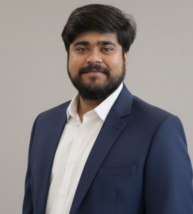
Ankush Chakraborty — GIS & Spatial Intelligence Expert
Scroll to explore

Professional Summary

Results-driven GIS Analyst with practical experience at Vasundharaa Geo Technologies, Pune, focused on geospatial data processing, remote sensing, and spatial analysis.

Proficient in industry-standard GIS software including ArcGIS Pro, QGIS, and Google Earth Pro, with hands-on skills in map creation, spatial modeling, and raster-vector data conversion.

Demonstrated expertise in satellite image classification, forest fire risk assessment, and training data preparation for machine learning models. Skilled in georeferencing, digitization, DEM processing, and layer reclassification.

Collaborative team player with experience in environmental monitoring, urban analysis, and decision support systems.

Spatial Analysis

Advanced geospatial processing & environmental monitoring

Remote Sensing

Satellite imagery classification & change detection

ML Data Prep

Training data for deep learning & machine learning models

Professional Journey

GIS Intern

Vasundharaa Geo Technologies Pvt. Ltd.

Jan 2025 – Apr 2025 Pune, India
  • Executed forest fire classification and frequency analysis using remote sensing data
  • Prepared high-quality training datasets for deep learning and machine learning models
  • Conducted geospatial data processing and spatial analysis for urban and environmental studies
  • Performed digitization, map design, and spatial modeling for web-based applications
  • Utilized raster-vector conversion and layer reclassification to streamline GIS workflows

Technical Skills

GIS Software

ArcGIS Pro QGIS Google Earth Pro ERDAS IMAGINE Google Earth Engine (Basic) Geoserver

Surveying & Data Acquisition

Total Station GPS DGPS UAV Mission Planner GeoSetter

Database & Analytics

SQL (Basic) Tableau Power BI Microsoft Office

Soft Skills

Team Leadership Time Management Adaptability Collaboration

Featured Work

01

GIS-based assessment of transportation network impacts on air quality, climate vulnerability, and public health.

This study develops a multi-layer geospatial intelligence framework to evaluate the environmental and health impacts of transportation infrastructure in Kolkata.

  • Assessed impacts of transportation networks on air quality, climate vulnerability, and public health
  • Analyzed spatial correlations between traffic density and environmental health indicators using GIS
GIS Analysis Air Quality Health Mapping
02

Spatio-Temporal Change Detection — Mukutmanipur (2014–2024)

Decadal land cover change analysis using multi-temporal Landsat 8 imagery, remote sensing indices, and 3D terrain modeling.

  • Analyzed decadal land cover changes using multi-temporal Landsat 8 imagery and QGIS
  • Integrated remote sensing indices with 3D terrain modeling and contour mapping
Landsat 8 QGIS 3D Modeling
03

Conference Presentation — GTSL 2026

National Conference on Geospatial Technologies and Sustainable Landscapes, Department of Geography (Geoinformatics), Savitribai Phule Pune University.

  • Presented research at a national-level conference on geospatial technologies
  • Engaged with academic peers and industry professionals on sustainable landscape analysis
Research Conference Feb 2026

Academic Background

Expected 2026

M.Sc. in Geoinformatics

Savitribai Phule Pune University

Pune, India

2024

B.Sc. (Hons) in Geography

University of Calcutta

Kolkata, India

2021

Class XII

West Bengal Council of Higher Secondary Education

Kolkata, India

2019

Class X

West Bengal Council of Secondary Education

Kolkata, India

Credentials & Training

Advanced Geospatial Technology & Its Application Research

IIARI · July 2024

QGIS and Its Applications

IIARI · May 2024

Information Technology Certification

Ramakrishna Vivekananda Mission · 2018

Life Beyond Maps

Languages

English Hindi Bengali

Interests

Landscape Photography Rail Photography Long-distance Cycling Trekking Cooking

Let's Connect

Open to research collaborations, internship opportunities, and GIS consulting projects.

Email

ankushchakraborty1125@gmail.com

Phone

Click to reveal my number

LinkedIn

ankush-chakraborty

Location

Pune, Maharashtra

From Kolkata, West Bengal